Export map to DXF
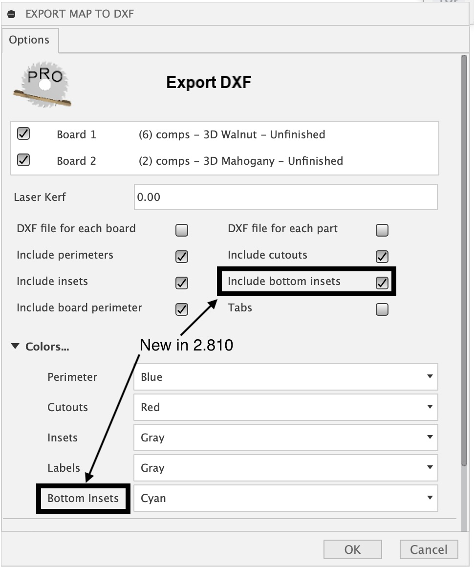
This task will export a flat panel design from the created map as a multi-layered DXF file. The layers created will represent a top view of each component in the map. The layers include perimeter, insets or pockets, cutouts and labels with descriptive layer names that include the depth relative to the top and a diameter for holes specified in default units. For inset features such as chamfers a depth range is provided. The Tabs option, when selected, will modify the perimeter in the DXF export to include tabs which are represented as breaks in the perimeter loops. The size of the breaks and distance apart are based on the provided options Width and Distance respectively. The Height option, when not set to zero, will result in an additional tabs layer being created. This could be useful with CNC users wanting to include tabs of a certain height.