Map Report
The Map Report task will create an HTML document which will be viewed in the default browser when the View option is selected. There are a number of options to customize the report as seen in the image below.
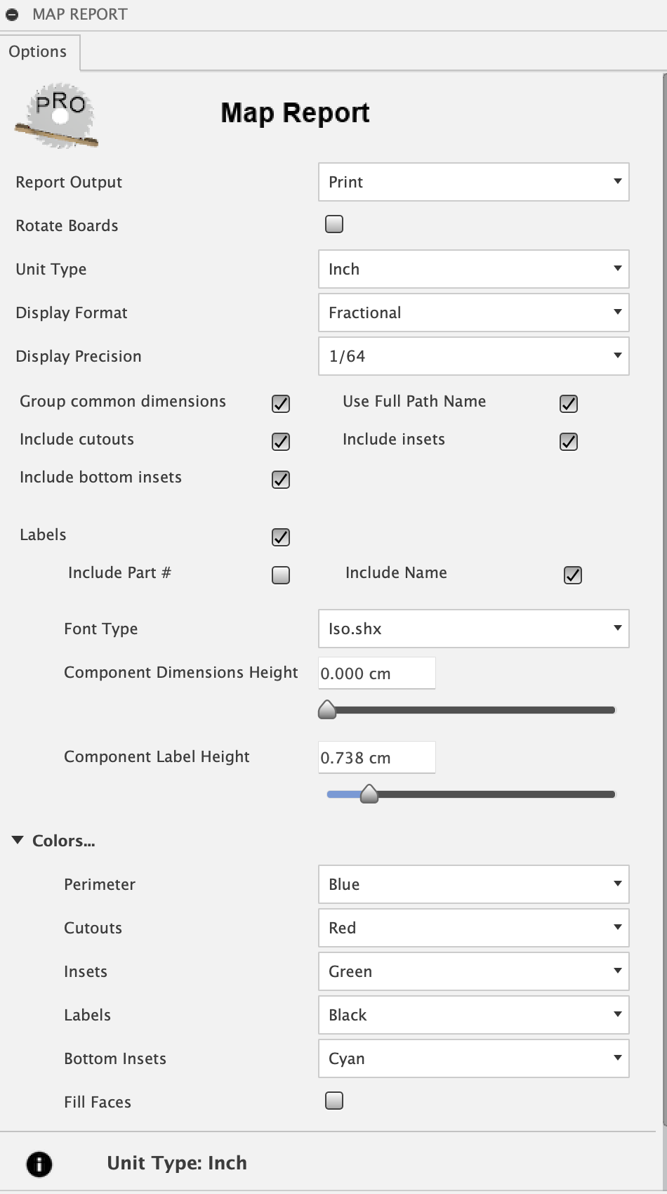
For labels both Part # and Name are optional and any combination is valid. The size controls the combination you select. Sliding the size to the far left will remove that element of the label. The map will be included with perimeter, insets or pockets, and cutouts set with selectable colors. Insets has a Grayscale color which when set will produce a varying grayscale color, the lighter gray for deeper inset pockets and the darker gray for shallow inset pockets.
The Report Output option includes the following:
- View
view the report with the default web browser when the report generation is complete
view a printable report with the default web browser print option which will allow the creation of a PDF output file or a printout
- Rotate
print option to rotate and scaled boards for improved readability
- HTML Only
generate the report HTML file without viewing in the web browser
- Group common dimensions
compress list by grouping to a single line components with common dimensions
- Use Full Path Name
Component names will include the entire unique full path as seen in the browser tree
The report will include the following views.
- Map
displays the list of boards and clicking on each board will display an image of the corresponding mapped board.
- Cutlist
displays a cut list of components sorted by Board, Width and Length. Components with matching width and length on the same board will be grouped into a single entry with the appropriate quantity.
- Materials
displays a list of board type and quantities required to manufacture the model. A board type is determined as a unique material and thickness pairing. The material is either the physical material or the material appearance if the Use Appearance option has been specified when the map was created.
- Options
displays the list of options used by MapBoards Pro to create the map. This can be useful when comparing the effect options have on the resulting map created. Just save the report with different meaningful name.
Sample Report
Use the Map, Cutlist, Materials and Options links to navigate through the report. The Help link is disabled in this sample since it displays this help. While viewed in a browser, pages from the report can be saved to PDF or printed.
View report here Sample Report